Sunday, July 27, 2014

Cadastral Map


https://www.tasmap.tas.gov.au/do/product/5438
(click View Sample Image)

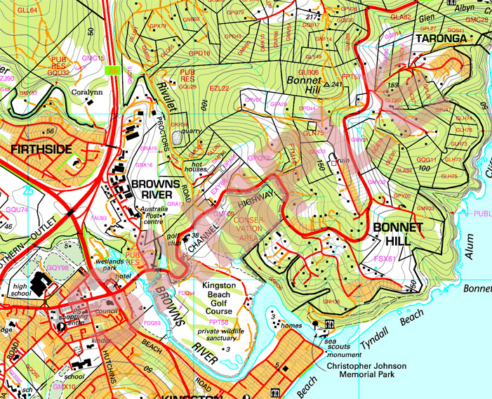
A cadastral map, is a comprehensive view of the metes-and-bounds system used on an area of land. A cadastral map shows details of the ownership, the tenure, the precise location, dimensions and the value of individual parcels of land. Most countries use cadastral maps for administrative and legal purposes to define as best as possible the dimensions and location of land parcels which are very useful to settle law suits and land disputes between neighboring land owners. The image above is that of a cadastral map in Australia that depicts parcels of land available for sale sectioned off into what I believe to be in polygonal sections that are measured in acres of land.


Thematic Map

(top-middle of page)
http://udel.edu/~csiwinsk/frec480/proj1/

A thematic map is a type of map or chart especially designed to show a particular theme connected with a specific geographic area. These maps inter-relate aspects of land use with complicated issues concerning politics, culture, and the physical environment. A thematic map is able to tell a story of what is occurring in an area in relation to human activity. The image above is a thematic map that tells a story of poverty within America where poverty  is shown to occur in the southern and northwestern parts of the United States.

Topographic Map

(top left)
http://geomart.com/products/topo/generaltopo.htm

A topographic map is a map type known for large-scale detail and representation of relief usually with contour lines. A topographic map is traditionally known with representing natural and man-made features. A topographic map is typically made in a series of prints so that when put together a larger map can be constructed. The image used as an example above is a section of the United States Geological Survey, particularly of the Cooper Rocks State Forest.

Thursday, July 24, 2014

Planimetric Map


A planimetric map shows only the horizontal position of features on the Earth's surface which show geographic objects, natural and cultural physical features whereas features like roads, buildings, and water bodies can be compiled into map features by surveying procedures. The planimetric map above is of Fort Vancouver, Washington from the United States Department of Commerce Coast and Geodetic Survey. This map is useful as a permanent record that provides a snap shot of what that area looked like before additional construction.

Mental Map

(middle)

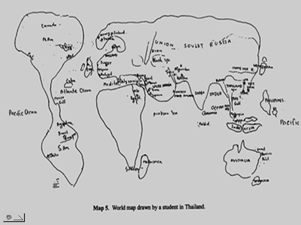
A mental map is one person's point of view of the world around them relative to location, space and distance. Also, a mental map is the culmination of one's personal experience with others as well as their own creativity. Mental maps differ from person to person. The mental map illustrated above is the world map drawn from a student from Thailand which is a unique perspective from that student.